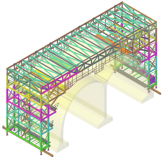
Computer-aided design (CAD) has irreversibly changed how things are built and manufactured, and few industries have been untouched by the power of design software. Almost everything we see and use on a daily basis has no doubt gone through various digital incarnations before becoming a reality. Our society is becoming increasingly populated by creations made possible by computer programmes, but now these digital tools are being used more frequently to shape how our towns and cities function as a whole.
What problems do urban planners face with existing towns and cities?
The layouts of existing towns and cities are very much a product of their history. Whilst this organic approach has resulted in very beautiful and characterful towns and cities all around the world, efficiency has often suffered. Cities like London that began as a small Saxon encampment and then swelled to become one of the world’s major metropolitan hubs often face issues with traffic and transport infrastructure that struggles to match the huge population growth. Even more modern cities like New York with its rigid and methodical ‘block’ layout are still subject to the same problems.
However, computer-aided design may be the ideal solution for infrastructure woes and worries facing town planners and builders.
Computer logic for the real world
The use of software for these applications compared to designing a new smartphone or rendering the inside of a new build house for a presentation is naturally very different. Aesthetics are placed to one side for the architects and/or designers to deal with and logistics are elevated above all. But although using CAD for town planning is more macro compared to product design, the way that software can be used to solve problems is very much the same.
As well as the obvious advantages of reducing cost and time consumption, potential schematics for a new neighbourhood or a re-design of an existing road network can be trialled and continually adapted to find an optimal solution in a fraction of the time taken by traditional methods.
Safety through simulation
Computer design also instils a degree of foresight into urban planners that traditional methods cannot. Thanks to the sophistication of these software packages, potential hazards or issues can be spotted through simulating different conditions or scenarios. A notable example of CAD’s preventative qualities is Canary Wharf – the distinctive ‘Gherkin’ shape is actually a result of computer simulations showing that the original design would result in potentially dangerous wind vortices around its base. With CAD being used now in the design of railways, bridges and tunnels where poor construction could result in fatalities, safety is a key priority and it is reassuring to know that these digital tools can be used to make our world safer as well as more aesthetically appealing.
Autodesk, the company responsible for the highly sophisticated and versatile AutoCAD package that we use for a variety of 2D and 3D modelling applications, has released a specialised programme designed for urban planning entitled Building Information Modelling (BIM). With this sophisticated tool, mocking up a planned development and assessing the viability of construction has become much easier and more cost effective.
Designers, architects, and 3D modellers are not the only people who can make use of CAD’s cornucopia of advantages over traditional methods of pen and paper. Computer-aided design has been responsible for many of the buildings we inhabit and the products we use on a daily basis, and soon it may very well be responsible for shaping our entire civilisation.
If you have design needs, whether 2D schematics, full 3D rendering or modelling for presentation, we can provide you with the design services you need to turn your idea into a reality.


